Zawiyyet Al Mayyiteen, the City of the Dead

Zawiyyet Al Mayyiteen (also known as Zawyet el-Sultan or Zawyet el-Amwat) is located on the southern edge of the city of Minya and is situated between the Nile river and desert cliffs to the East. Often called the “City of the Dead,” it is considered one of the largest cemeteries in the world, measuring nearly 4 kilometers long and 300 meters wide, covering roughly 1.2 square kilometers. Zawiyyet Al Mayyiteen is not just a modern cemetery; it is built atop layers of ancient history spanning nearly 5,000 years.

The cemetery is 4 kilometers long and 300 meters wide and is situated between the Nile and Desert Cliffs.

The site is easily identifiable by the repetition of small scaled domes made of mudbricks and plaster. Each domed mausoleum belongs to a different family and ancestral lineage. The highly concentrated sea of domes is easily read as a single web structure or pattern resembling the geological landscape, its growth seems fairly gradual and responsive to the site.

Looking at the Nile from within the cemetery.

This style of burial is traditional for the region, used by both the local Muslim and Coptic Christian communities, making it a rare site of shared funerary heritage.

Mausoleums against the cliffside.

During religious holidays and annual festivals, thousands of people from Minya travel to the site to visit their ancestors, often staying in the mausoleums to share meals and offer prayers.

Interior view of domed structure.
Mudbrick and plaster in various conditions.

The unique aesthetic of the domes has long inspired artists and photographers. The nearby village is also home to the museum of the famous Egyptian folk artist Hassan el-Shark, whose colorful paintings often depict the daily life and spiritual traditions of the Minya region.

Domes of mud brick and paster.

Resources

https://www.jennyfaraway.com/el-minya-cemetery/

https://arquitecturaviva.com/articles/necropolis-de-egipto-de-manuel-alvarez-diestrohttps://www.egypttoursportal.com/en-us/blog/minya-attractions/the-great-attractions-of-minya/

https://egyptfwd.org/Article/6/2265/City-Of-The-Dead-An-Endless-Sea-Of-White-Conical

https://www.atlasobscura.com/places/city-of-the-dead

https://www.google.com/maps/place/

Aseer Regional Architecture


Asir, or officially the Aseer Province in Saudi Arabia, was incorporated into the Kingdom of Saudi Arabia in 1934.  has a population of 2.2 million. The province has a long history with artifacts dating to the bronze age. The region is known for its tribal independence, agriculture, and high-altitude culture, situated on a high plateau.

The Aseer region is characterized by a cooler climate with considerable seasonal rain. It has approximately 400 traditional settlements, many located on the high plateau at altitudes greater than 2000 meters. Buildings generally took the form of square, multistory towers. Four principal construction types developed based on the local microclimate and available materials: mud tower houses, stone rubble houses, stone apron houses, and mud and slate tower buildings.

Rijal Almaa is a town that emerged 900 ye  ars ago and, given its strategic location on the route to Mecca from Yemen, it became a place of commercial exchange. The buildings are composed of stone, mud, and wood, and are constructed up to six floors. They are detailed with with white window frames, wooden shutterns, and decorative mofits, details that are characteristic of the region.

Rijal Almaa Heritage Village consists of around 60 traditional stone, mud, and wood buildings.
White window frames and checkered details

Typical  houses in the mountainous Asir province were made of mud reinforced with camel hair. The lower areas of the buildings were made from stone, with smaller flat stones wedged between bigger ones. The upper areas have a local flat stone between the bricks. Plaster was usually applied to the outside of the building to cover the mud bricks.

Al-Qatt Al-Asiri is a traditional interior wall decoration of the region. It is a spontaneous art technique carried out largely by women. It is typically practiced on rooms of visiting guests. Women invite female relatives of various age groups to help them in their homes, thereby transmitting this knowledge from generation to generation. The base is usually white gypsum and the patterns consist of icons of geometric shapes and symbols.

© 2016 by Ahmad AlSheme, Saudi Arabia
Aseer Craftsmanship
Aseer Craftsmanship

The Saudi government has developed set of architectural and urban guidelines and requirements that help guide the design and urban development process to align with the authentic local architectural style of each geographic area across the Kingdom.  Guidelines, maps, and more information can be found here: https://architsaudi.dasc.gov.sa/ar

Aseer Escarpment, Architectural Design Guidelines

Aseer Escarpment, Architectural Design Guidelines, Page 5
Aseer Escarpment, Architectural Design Guidelines, Page 13
Aseer Escarpment, Architectural Design Guidelines, Page 14

Al-Qatt Al-Asiri, female traditional interior wall decoration in Asir, Saudi Arabia

Craftsmanship of decorated wooden doors reflects Aseer’s artistic heritage

Rijal Almaa Heritage Village in Assir Region

Diriyah, Saudi Arabia

Basic Information

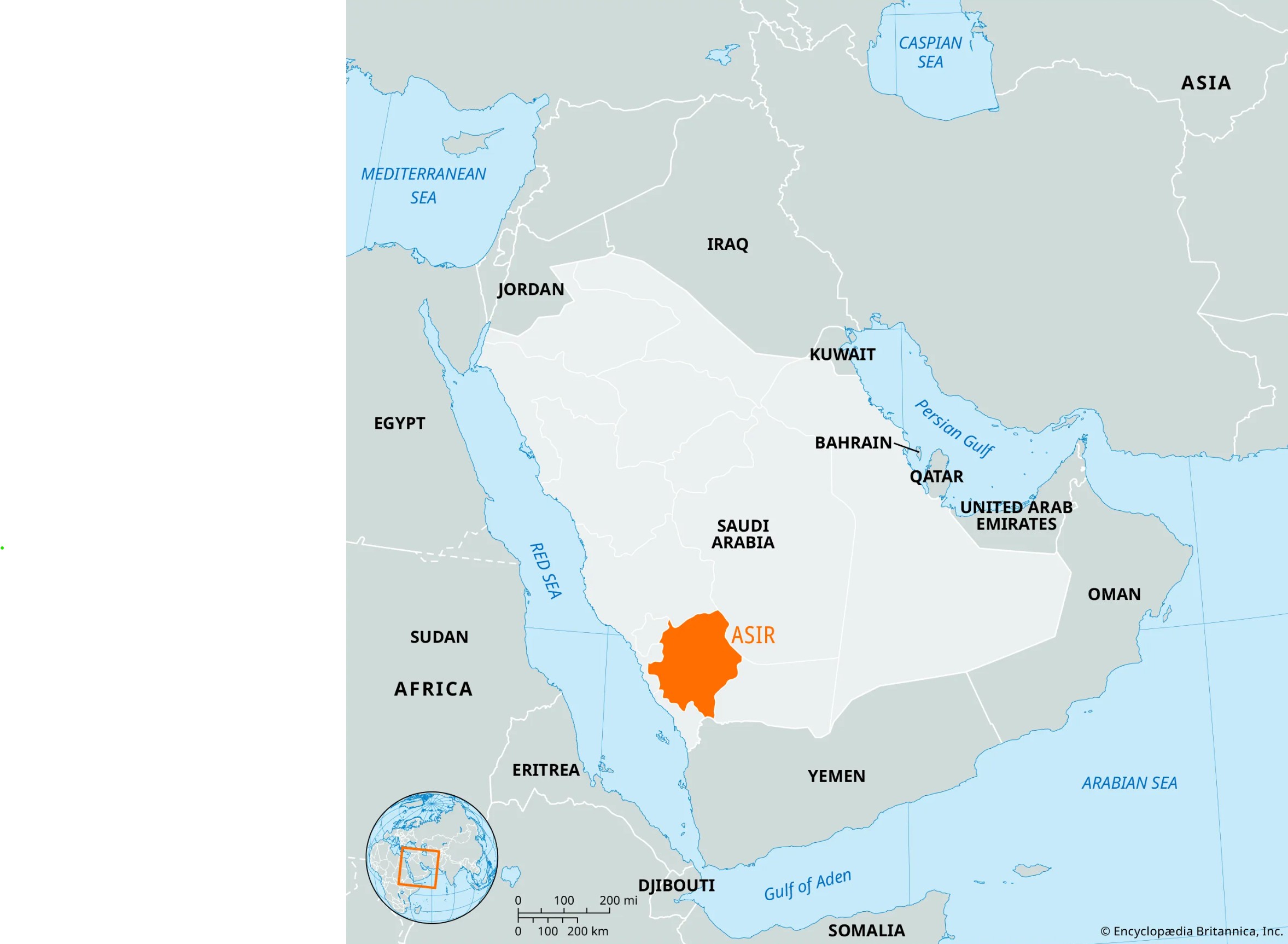
Location: Diriyah, northwest of Riyadh, Saudi Arabia
Type: Historic earthen settlement / urban heritage site
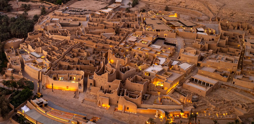
Historic Core: At-Turaif District in ad-Dir‘iyah
Period: Founded in the 15th century; major political role in the 18th–early 19th century
UNESCO Status: World Heritage Site, inscribed in 2010
Primary Material: Traditional Najdi mudbrick / earth-based construction

Overview

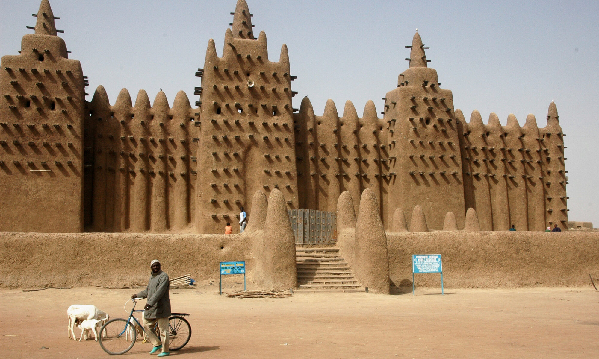
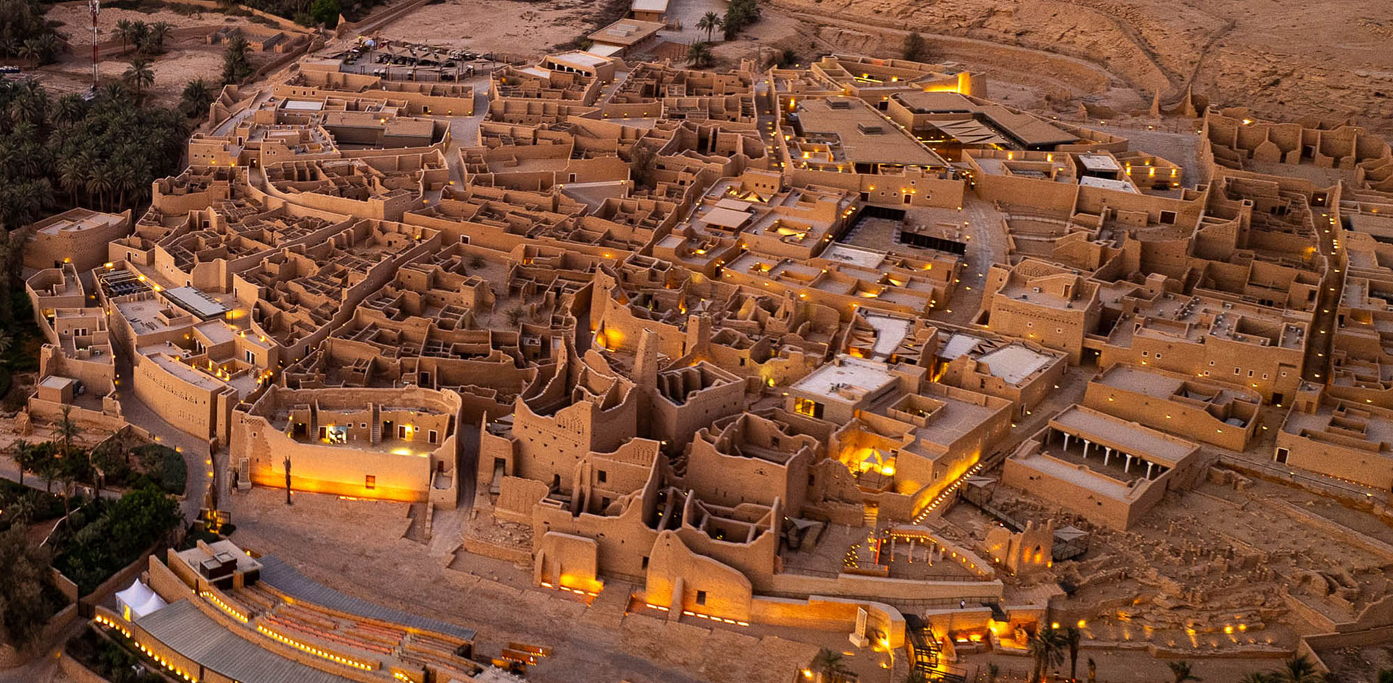
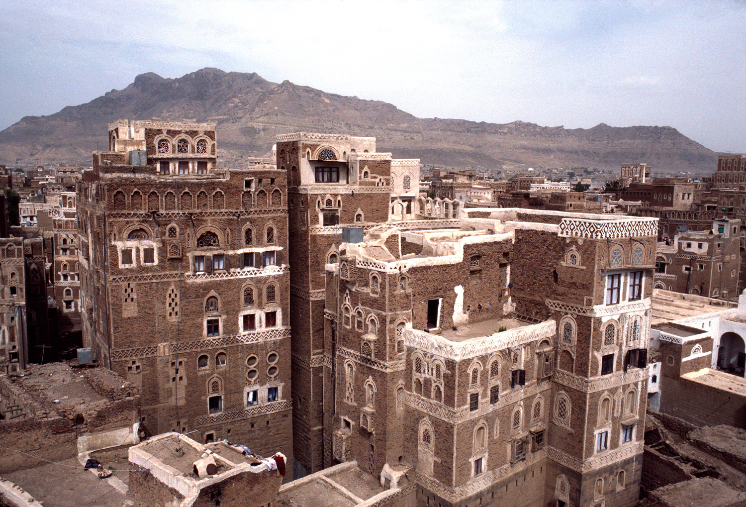
Diriyah is a historic urban landscape shaped by earth construction. Its significance lies in the way architecture, settlement form, climate adaptation, and political history are bound together in one place. UNESCO describes At-Turaif as the first capital of the Saudi Dynasty and a witness to the Najdi architectural style specific to the center of the Arabian Peninsula. This means Diriyah is important not only because it uses earth as a material, but because it demonstrates how earthen architecture can operate at the scale of an entire city: walls, palaces, streets, courtyards, defensive structures, and urban hierarchy are all formed through related material and spatial logics.

Historical and Cultural Context

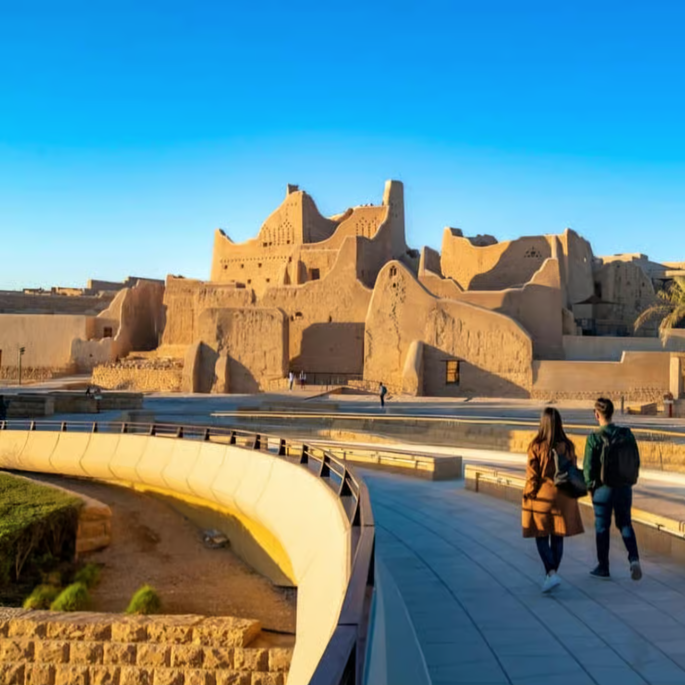
Diriyah’s importance is inseparable from its role in Saudi history. The official Diriyah site describes At-Turaif as the heart of the Emirate of Diriyah, the First Saudi State, built from traditional Najdi mudbrick and overlooking Wadi Hanifah and the Diriyah oasis. UNESCO likewise identifies it as the first capital of the Saudi Dynasty. These descriptions matter because they show that the architecture of Diriyah is not merely vernacular in the sense of being local and anonymous; it is also political, dynastic, and symbolic. Earth architecture here was used not only for domestic life, but also for governance, defense, and the representation of power. In other words, Diriyah demonstrates that earthen architecture can be monumental and state-forming, not only rural or modest.

Landscape and Settlement Logic

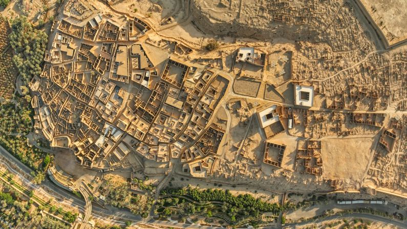
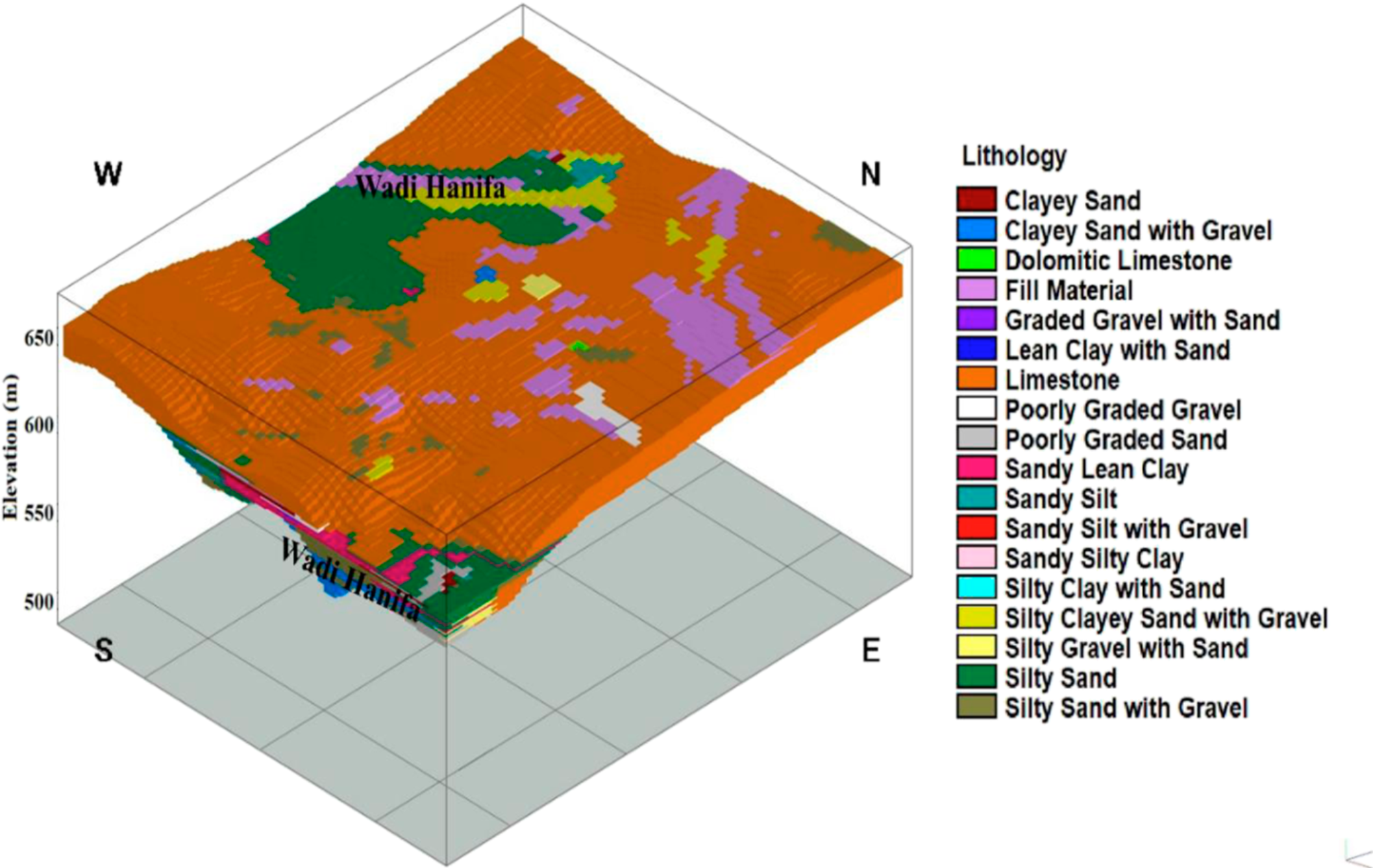
Diriyah is also a settlement shaped by its landscape. UNESCO and other heritage descriptions emphasize its position near Wadi Hanifah, where oasis conditions, topography, and defensive needs influenced how the city developed. This relationship to the valley matters because earthen settlements are often misread as isolated objects, when in fact their form emerges from water access, terrain, and patterns of protection and movement. In Diriyah, the historic district occupies an elevated position overlooking the wadi, which strengthened both its defensibility and its visual authority. The city therefore should be read as an environmental and territorial construction as much as an architectural one.

Material System

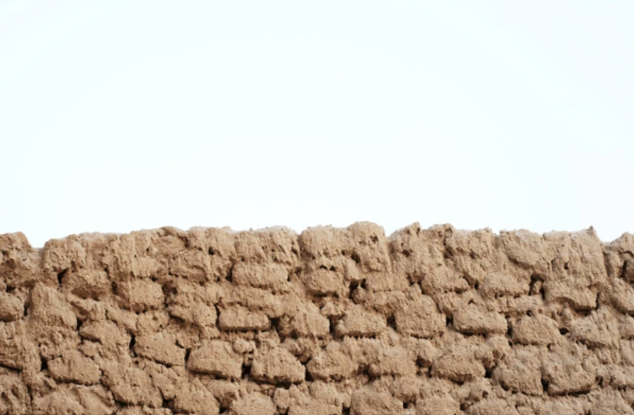
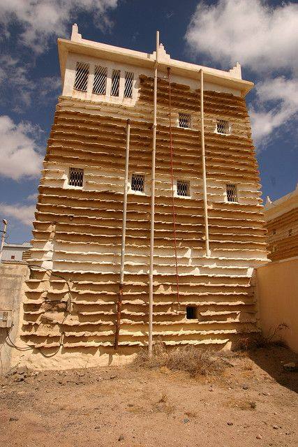
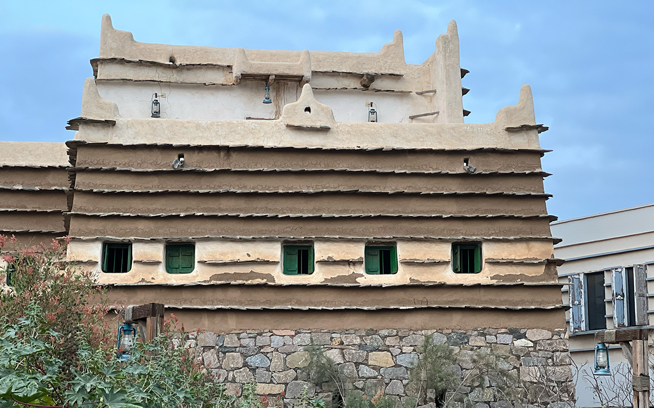
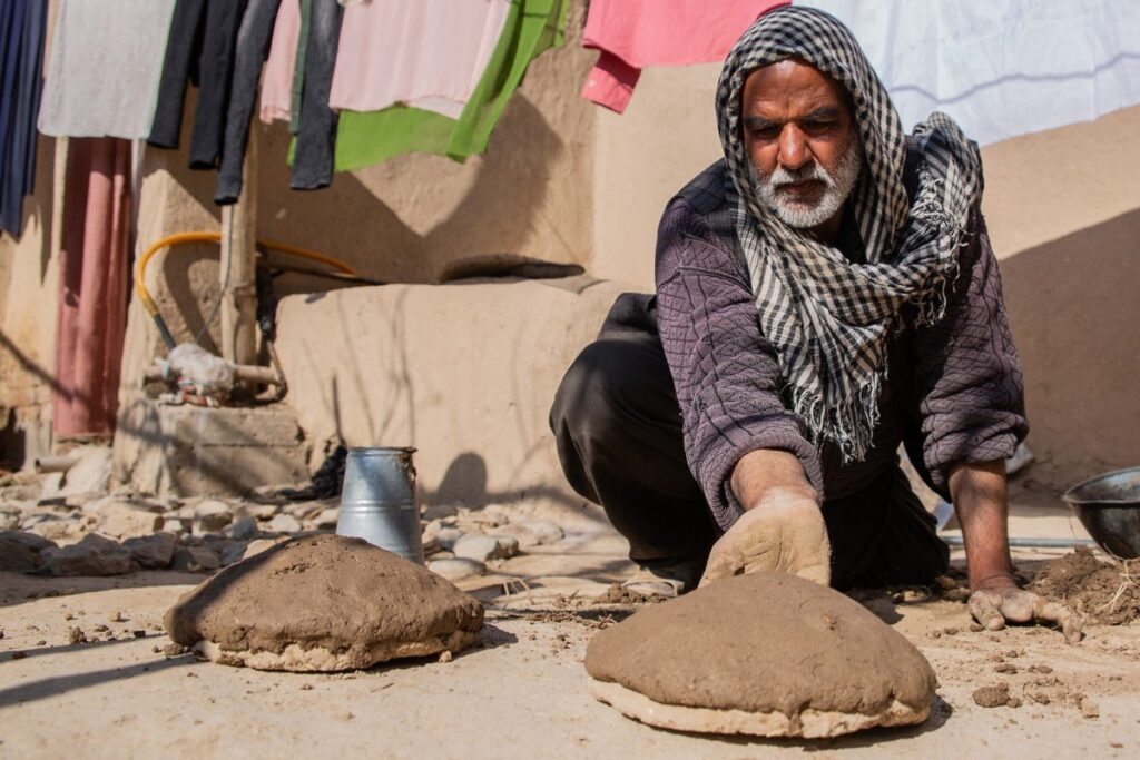
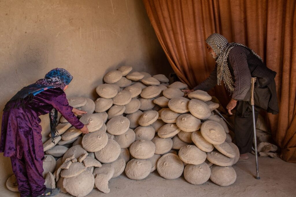
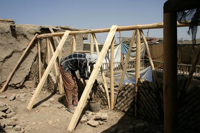
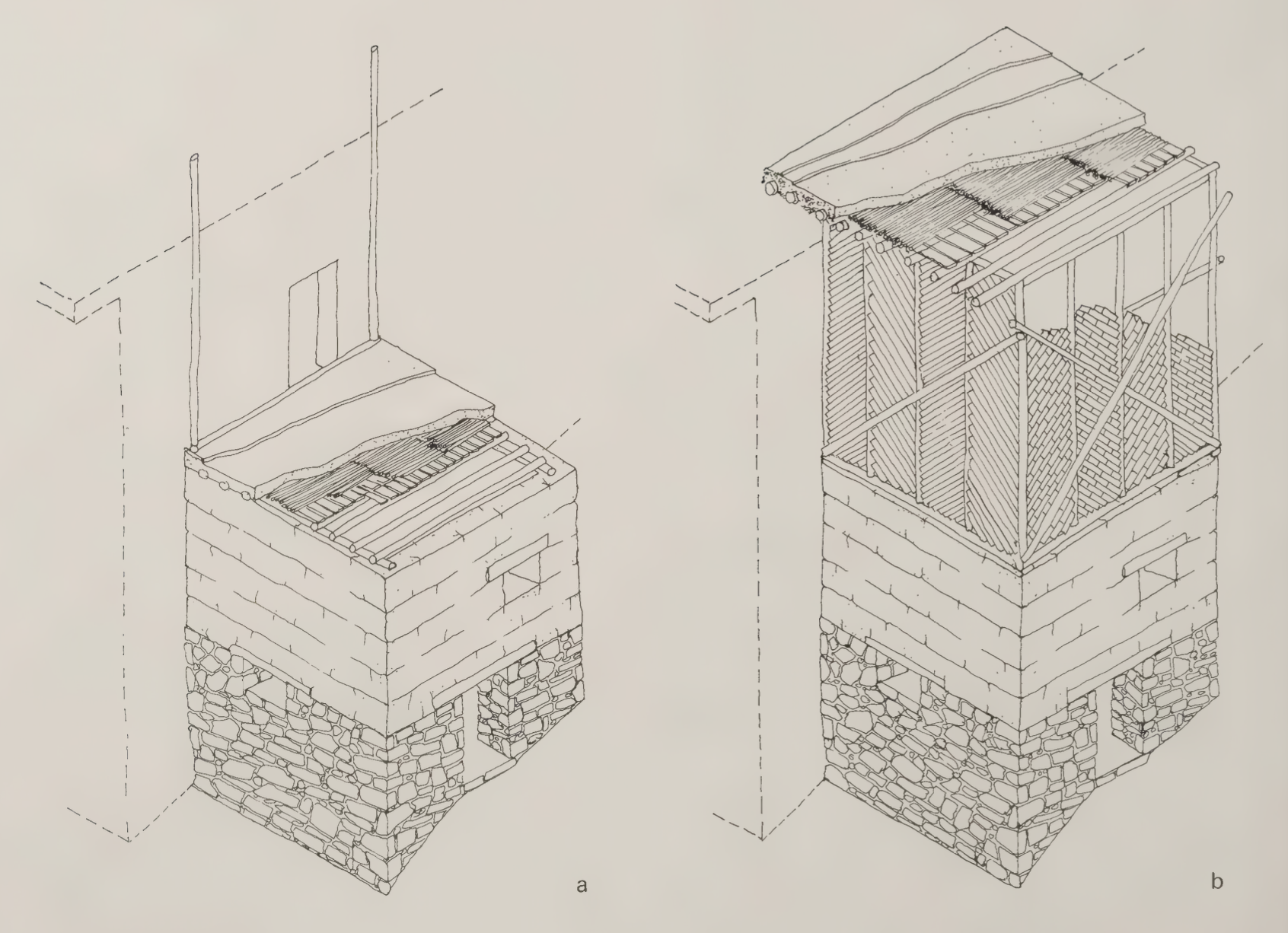
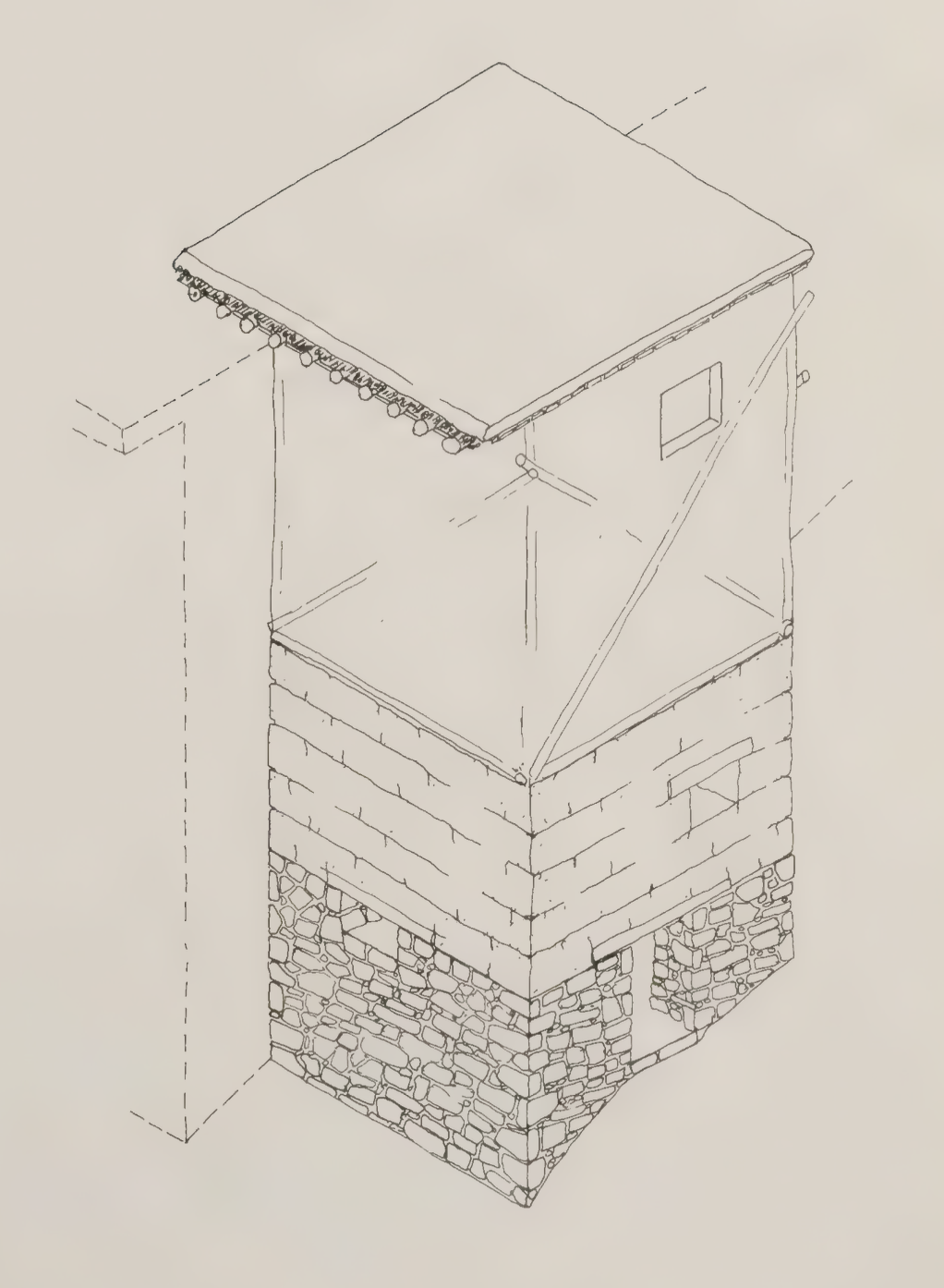
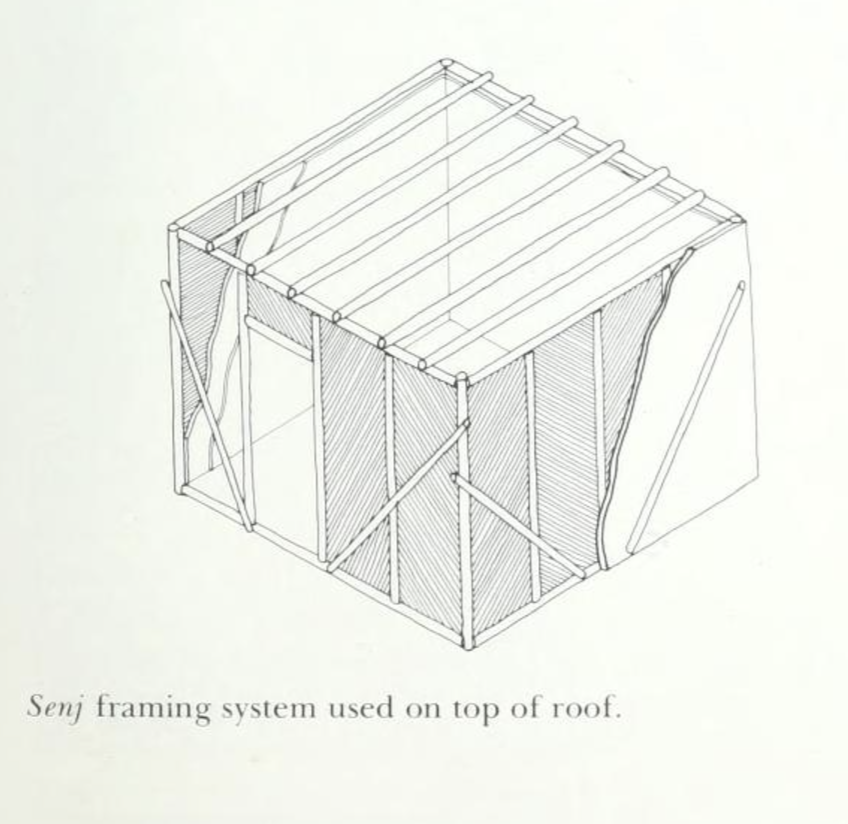
The material system of Diriyah is fundamental to understanding its architecture. The official Diriyah site repeatedly describes At-Turaif as built from traditional Najdi mudbrick, while tourism and heritage descriptions emphasize its mud-brick character at the scale of the entire district. Mudbrick construction relies on locally available earth, shaped into units and dried before assembly into thick walls. What matters here is not only that the material is local, but that it forms a coherent construction culture: the material, the wall thickness, the maintenance cycle, and the architectural language all depend on one another. Earthen construction in Diriyah is therefore not a superficial finish or a nostalgic aesthetic; it is the structural and cultural basis of the settlement itself.

Architectural Features

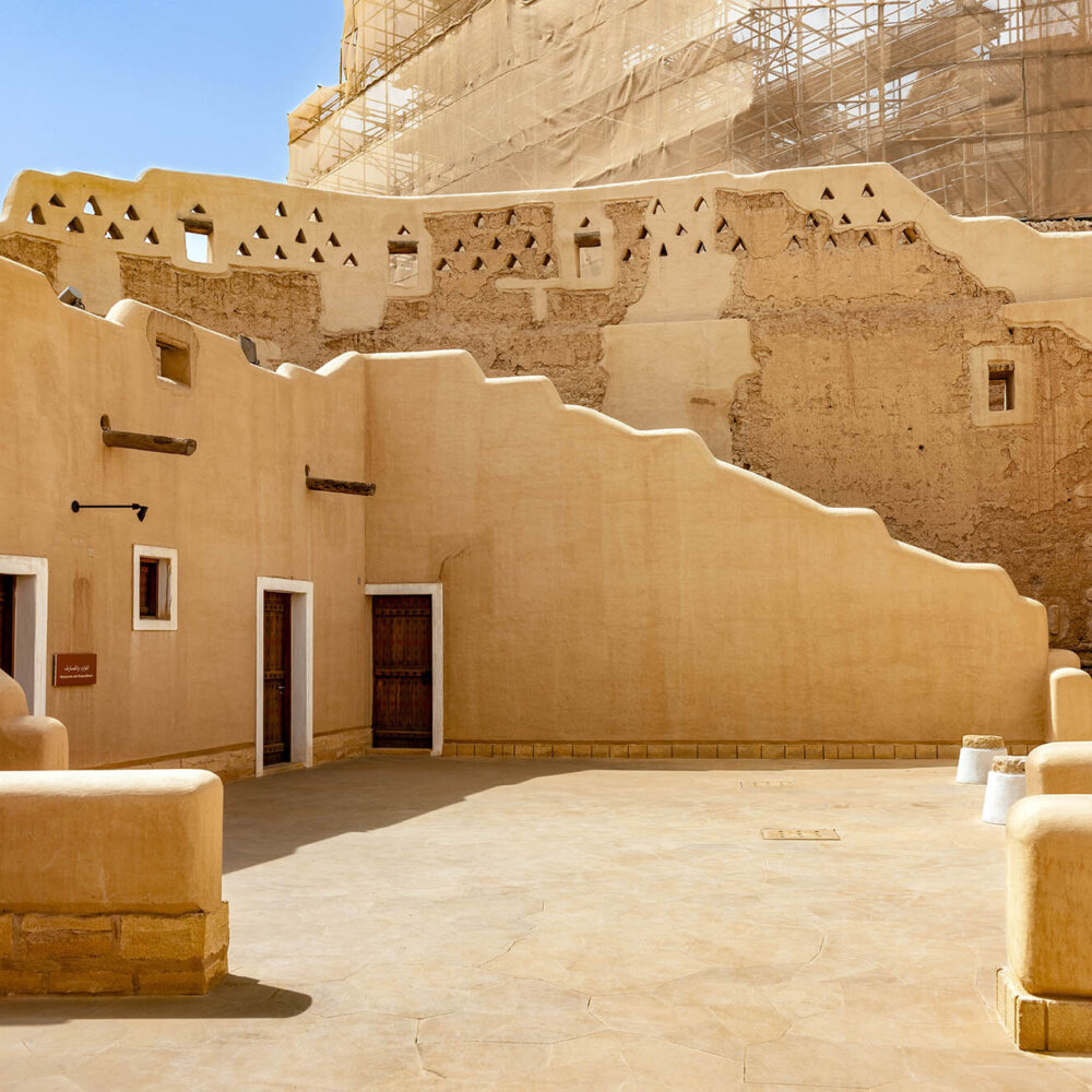
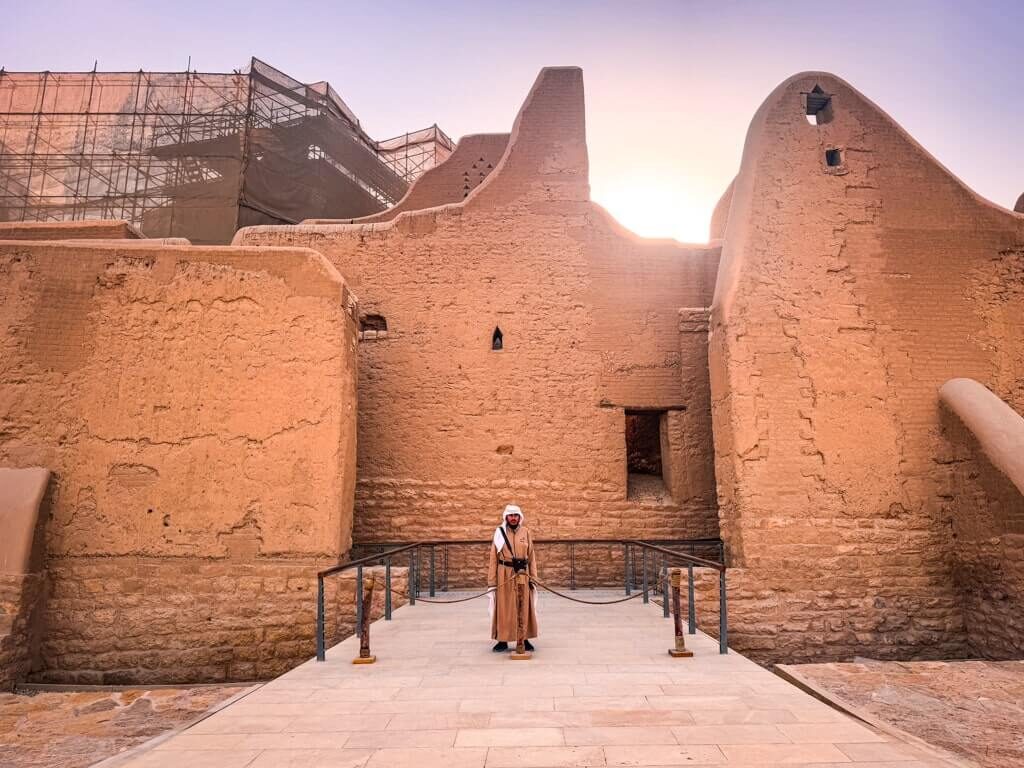
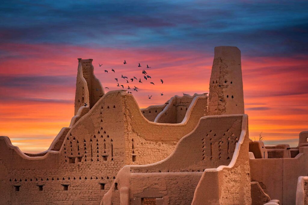
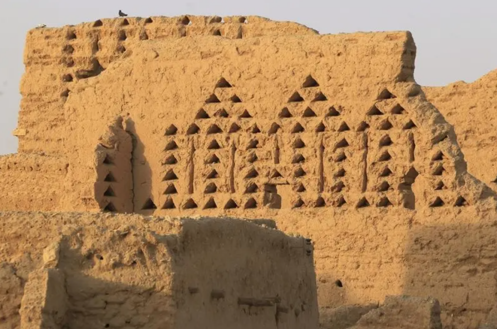
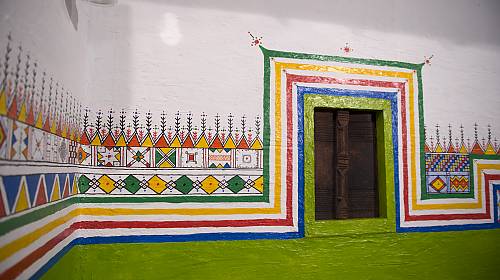
UNESCO identifies At-Turaif as a major example of Najdi architectural style, and this style can be understood through a set of recurring spatial and formal features: thick earth walls, carefully controlled openings, inward-oriented compounds, courtyards, and a dense urban fabric. These features are not isolated details; together they produce an architecture of mass, shade, privacy, and gradated enclosure. The city’s buildings do not rely on glassy openness or long-span structural expression. Instead, their character comes from the sculptural handling of mass and void. This is why Diriyah is so important within earth architecture studies: it shows how an entire urban language can emerge from the properties of earth itself.

Earthen Monumentality and Urban Scale

A deeper reason Diriyah matters is that it challenges a persistent misconception about earthen architecture: that earth belongs only to small, rural, or informal buildings. At-Turaif shows the opposite. UNESCO presents it as a dynastic capital, and the official Diriyah materials present it as a mud-brick citadel central to the making of the Kingdom. This means earth here operates at the scale of monument, palace, district, and capital city. Its essential to mention: Diriyah broadens the imagination of what earthen construction can be. It is not only a technology of shelter; it is also a technology of urban order, representation, and political centrality.

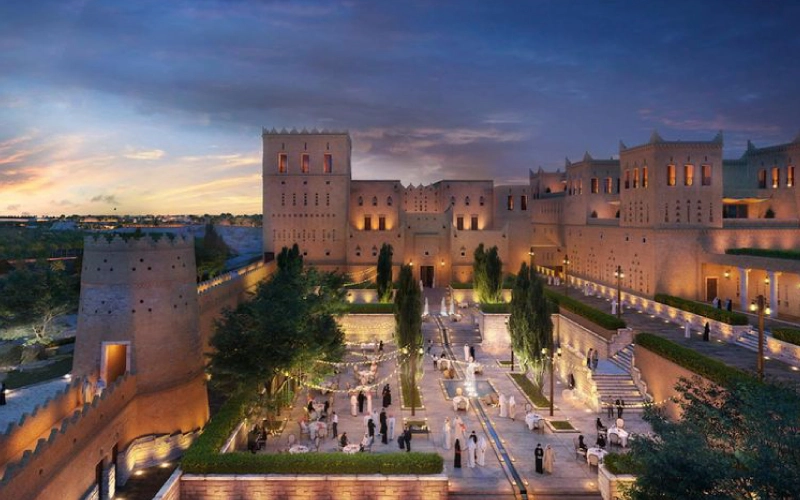
Contemporary Relevance

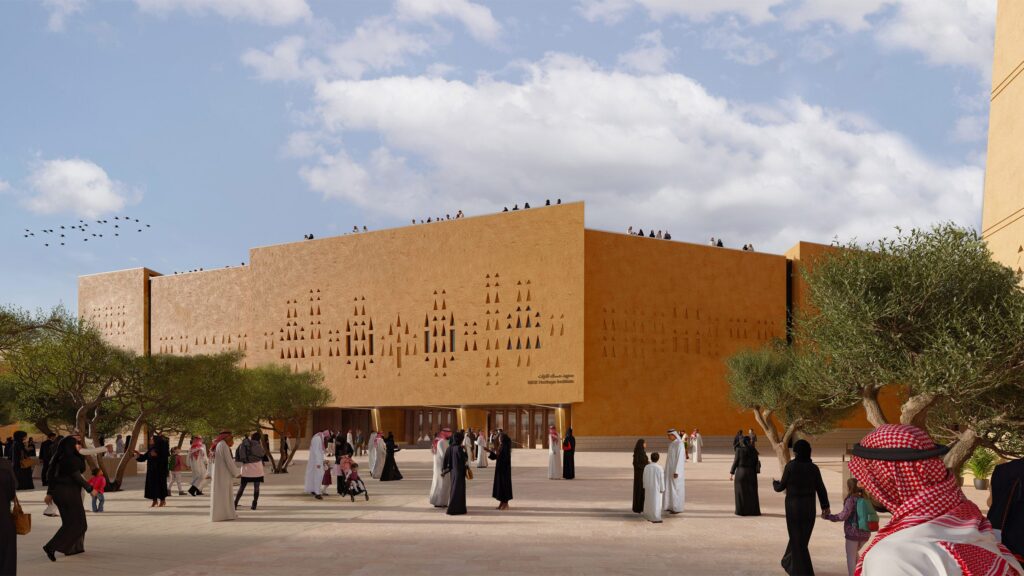
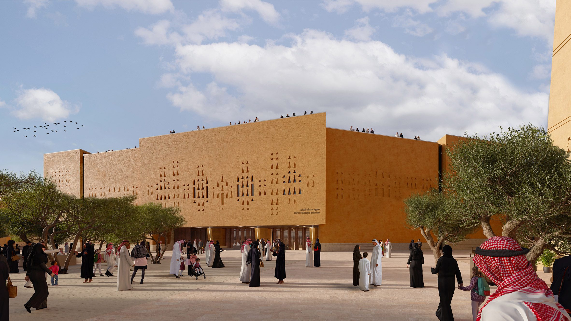
Diriyah remains highly relevant to contemporary architecture because it continues to function as a reference point for new work. Recent architectural coverage of projects in Diriyah, including Zaha Hadid Architects’ Asaan Museum, explicitly states that the site’s mud-brick architecture and centuries-old urban fabric are the source of inspiration, and that the project will use locally sourced clay mud-bricks. This is significant because it shows that Diriyah is not treated merely as a museum object frozen in the past. Instead, it acts as a living precedent for how local material intelligence, Najdi form, and climatic knowledge can be reinterpreted today. In that sense, Diriyah is both an origin and an ongoing design reference for contemporary earthen practice.

Conclusion

Diriyah is a foundational case in earth architecture because it demonstrates that earthen construction is not simply a matter of material substitution. It is a complete architectural and urban system in which politics, landscape, craft, climate, and form are interdependent. Its buildings are made of earth, but its significance goes beyond materiality alone: Diriyah shows how earth can generate a capital city, a heritage landscape, a climatic urbanism, and a continuing source of architectural knowledge. For that reason, it should be understood not as a relic of a premodern past, but as one of the clearest and most enduring demonstrations of earth architecture’s intelligence and relevance.

References

  1. UNESCO World Heritage Centre, At-Turaif District in ad-Dir‘iyah. https://whc.unesco.org/en/list/1329
  2. Diriyah official website https://www.diriyah.sa/en/history-and-culture
  3. ArchDaily, Asaan Museum in Diriyah, Saudi Arabia. https://www.archdaily.com/1030338/zaha-hadid-architects-breaks-ground-on-asaan-museum-in-diriyah-saudi-arabia
  4. Islamic Architectural Heritage / IRCICA, background on ad-Dir‘iyah and Wadi Hanifa. https://www.islamicarchitecturalheritage.com/listings/historic-at-turaif-district-diriyah
  5. Visit Saudi, At-Turaif World Heritage Site.  https://www.visitsaudi.com/en/diriyah/attractions/at-turaif

Kangina

A paper-lined kangina, opened to access the grapes stored inside. Credit: Voice of America

Kangina (Dariکنگینهlit.treasure),  is the traditional Afghan technique of preserving fresh fruit, particularly grapes, in airtight discs formed from mud and straw.

This technique has been practiced for centuries, particularly in rural regions of central and northern Afghanistan, where access to imported fresh produce is limited during winter months. Grapes stored in kangina can remain fresh for up to six months, allowing communities to extend seasonal harvests and enabling merchants to transport fruit over long distances without spoilage.

Ziaulhaq Ahmadi makes bowls of mud and straw for fresh grapes. Credit: Atlas Obscura

The container is formed by shaping two shallow, bowl-like shells from a mixture of clay-rich mud and straw, which are then dried in the sun. Fresh, undamaged grapes—typically thick-skinned varieties such as Taifi or Kishmishi—are placed inside before the two halves are sealed together with additional mud, creating an enclosed volume. The finished vessel is stored in a cool, dry environment, protected from direct sunlight.

Sabsina shows where the family stores the kangina: in a dry, cold space, away from direct sunlight. Credit: Atlas Obscura

Kangina functions as a passive controlled-atmosphere system. Although the mud shell appears sealed, it remains microscopically porous, allowing a slow and continuous exchange of gases between the interior and exterior. Oxygen gradually diffuses into the container, enabling the grapes to remain alive, while carbon dioxide produced through respiration accumulates inside. This elevated concentration of carbon dioxide slows metabolic activity and inhibits the growth of fungi and bacteria, effectively delaying spoilage without the need for mechanical refrigeration.

At the same time, the material properties of the mud contribute to humidity regulation. The earthen shell absorbs excess moisture released by the fruit, preventing condensation and reducing conditions favorable to microbial growth. This balance of gas exchange and moisture control creates a stable internal microclimate that preserves the grapes’ freshness, texture, and nutritional quality over an extended period.

Historically, similar techniques have been documented as early as the twelfth century. In his Book of Agriculture, the Andalusian agronomist Ibn al-‘Awwam described methods of storing grapes in mud-sealed containers layered with straw, indicating a long-standing tradition of using earthen materials to regulate environmental conditions for food preservation.

Kangina remains an inexpensive, environmentally sustainable, and effective method of storage. It requires no external energy input and relies entirely on the intrinsic properties of natural materials. However, the containers are relatively heavy, fragile, and susceptible to absorbing external moisture, which can affect their durability and performance in certain conditions.

“Kangina.” Wikipedia. Last modified 2023.  https://en.wikipedia.org/wiki/Kangina

Glinski, Stefanie. “The Ancient Method That Keeps Afghanistan’s Grapes Fresh All Winter”. 2021. Atlas Obscura.

Zabur in Yemen

Aljazeera

The Architecture found in Yemen is among the most sophisticated and enduring traditions in human history – a monument to the reaches that people could build to even without modern, post-industrial materials and methods. These relics, often older than 500 years old, are more at risk than ever, due to socio-political issues in yemen.

Central to this architectural tradition is the “zabur” technique, which is among a collection of practices essential to earthen architecture in Yemen, from the coursed-clay methods in the highlands to the iconic “gingerbread” fired-brick patterns found in the capital, Sana’a.

The master builders “ustads” utilize several distinct systems based on the required outcome – each varying the preparation of the earth, the firing or not-firing of that earth, and the methods of application. This allows zabur to adapt to the various features of the yemeni landscape – optimizing from the humid coastal plains to the volcanic plateaus.


NBC NEWS

In technical literature, “zabur” is defined as a direct-forming technique – utilizing wet, straw-reinforced clay soil to build walls without the use of formwork or molds. This is reminiscent of the European technique of “cob.” This definition of the term, however, is limited – and many linguists and experts of old Sana’a argue that it’s also inextricably linked to the intricate patterns of the fired-mud bricks that comprise much of the city’s facades. This intertwines the later, post-Islamic styles of decorative brick-and-gypsum towers with the ancient past’s monolithic clay walls – what I’ll call “pure zabur.”

ArabAmerica

In the northern regions, zabur remains as a pure coursed-clay tradition. The material is prepared in pits and formed into balls, which are then thrown to the master mason standing on top of the wall, who settles the material into place. In Sana’a, the zabur is the fired mud-bricks that are adorned with ornamentation drawn of white gypsum.

Tower House

These techniques allowed Yemeni to build stronger, and then eventually higher – leading to the creation of tower houses. These traditional tower houses in the old cities were set on stone foundations of basalt, on top of which carefully fitted, locally quarried tuffa and limestone up to 10 meters tall is laid. Above that, the zabur bricks are laid – and then on top of that an aged lime plaster called qadad is applied as an exterior waterproofing layer (atleast on the rooftops).

MIT Libraries

Yemeni Architecture reflects a “profound interaction between humans and their environment“(IJSDP), standing as a creative embodiment of beauty, simplicity, and the extents of human ingenuity of the past. Rapid urban development in recent years, however, has created disharmony and a detachment from societal traditions – something that looking at and preserving techniques from the past may help with reconciling.


Sources:

https://www.aljazeera.com/news/2020/10/16/mud-brick-palace-is-yemens-latest-heritage-site-facing-disaster

https://www.nbcnews.com/news/photo/yemenis-make-mud-bricks-unique-architecture-flna1c7186688

https://www.mutualart.com/Article/The-Yemen-s-mud-brick-buildings/573E9A38ED3968A1

https://www.researchgate.net/publication/387526551_Form_and_Content_in_Yemeni_Architecture_Exploring_Continuity_Mechanisms_of_Heritage_-_A_Case_Study_of_Sana’a_City

https://newsociety.com/wp-content/uploads/woocommerce_uploads/toc-excerpt/Essential-Cob-Construction_excerpt.pdf

https://dev.earth-auroville.com/stacked-earth-cob/

Traditional Yemeni Architecture: Craftsmanship and Sustainability

Senj: Afghan Wood Framing Technology

Senj: Afghan Wood Framing Technology. 1’/1.5” scale. Pine, earth, and poplar

Senj (سنج) is a traditional Afghan wood framing technique. It is a lightweight, flexible, and modular system designed to be placed on upper levels of structures within earthquake prone regions of Afghanistan.

Amin House Restoration, Kabul, Afghanistan 2004-2005. https://www.archnet.org/sites/5585
Filling of timber parapet frame with mud-bricks. Amin House Restoration, Kabul, Afghanistan 2004-2005. https://www.archnet.org/sites/5585

The frame is constructed with poplar poles on a flat surface and is joined together to create square or rectangular walls. The horizontal poles are around 15-20cm in diameter, and the vertical/diagonal poles around 10-15cm. They are joined by mortise and tenon about 1m apart, where they are then filled with sun-dried bricks, placed at a diagonal relationship between the vertical and diagonal poles.

Drawings from the book Afghanistan: An Atlas of Indigenous Domestic Architecture p.154

The infilled brick frames are then plastered with a mud and straw mixture on both the interior and the exterior facades. It seems that over time, however, the diagonal poles have been integrated into the complete frame, plastered over and completely hidden. Notice this drawing:

Drawing showing the exposed poplar diagonal pole, from the book Afghanistan: An Atlas of Indigenous Domestic Architecture p.153
Drawing showing the exposed poplar diagonal pole, from the book Traditional architecture of Afghanistan p.187

The diagonal bracing pole is left exposed outside of the plaster, as seen in these photos:

Vernacular Housing of Kabul, 2006, https://www.archnet.org/sites/5610.
Vernacular Housing of Kabul, 2006, https://www.archnet.org/sites/5610

Here on the left side wall, all poles have been plastered over and no remnants of the structure are exposed. Could the strength have increased by having the diagonals be integrated into the frame, rather than existing on the exterior of it?

Amin House Restoration, Kabul, Afghanistan 2004-2005. https://www.archnet.org/sites/5585

In Afghanistan: An Atlas of Indigenous Domestic Architecture, the authors state that diagonal poles are *nailed* at the exterior corners to stabilize the frame, not integrated within the frame itself. It is beautiful to witness the underlying structure with the poplar poles exposed as such in the older buildings, and saddening to see that design decision disappear over time. Even more so it is a shame the patterning that the bricks create are also plastered over and disappear. We wonder how senj technology can be re-contextualized contemporarily to become a textural, aesthetic, modular device while also supplying firm, structural integrity to a design.

Thank you so much to Professor Ronald Rael for opening the doors of knowledge, wisdom, research and discovery of ancestral design within the context of Architecture at UC Berkeley.

Senj: Afghan Wood Framing Technology. 1’/1.5” scale. Pine, earth, and poplar

Omar Mohammad & Monica Leslie
Berkeley, December 2024

Works cited

“Archnet > Site > Amin House Restoration.” n.d. Accessed December 3, 2024. https://www.archnet.org/sites/5585.

“Archnet > Site > Vernacular Housing of Kabul.” n.d. Accessed December 3, 2024. https://www.archnet.org/sites/5610.

Hallet, Stanley Ira, and Rafi Samizay. 1980. Traditional Architecture of Afghanistan. New York: Garland STPM Press.

Szabo, Albert, and Thomas Jefferson Barfield. 1991. Afghanistan: An Atlas of Indigenous Domestic Architecture. Austin: University of Texas Press.

The Pottery Dome

As architecture students, we (Sascha Fawaz and Pedram Modaresi) built a dome structure/prototype merging pottery vessels with clay construction. Inspired by the Reviving Al Nazlah Center (Oriental Group Architects and Hamdy El-Setouhy) in Egypt, our installation transforms clay pots into architectural elements.

Our project focused on using pots as modular units for construction, integrating them into both the facade and roof.  Domes and curved surfaces formed the core of our design, emphasizing spans and spaces that feel timeless yet innovative.

We were fascinated by the dialogue between ancient techniques and modern design sensibilities in the precedent project, reflecting a deep respect for craftsmanship while pushing the boundaries of what’s possible with humble materials like clay and pottery. It not only bridges the gap between past and present but also exemplifies the potential for sustainability, cultural revival, and community empowerment through architecture.

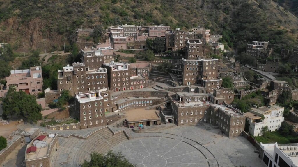
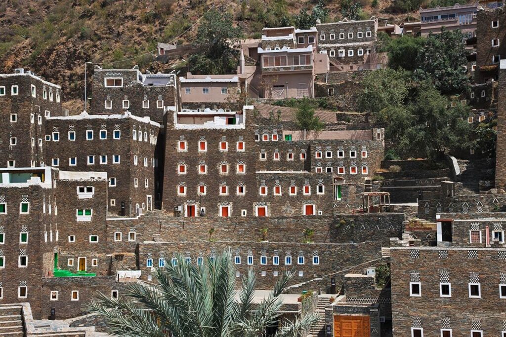
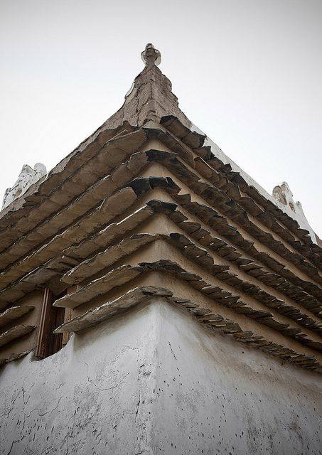
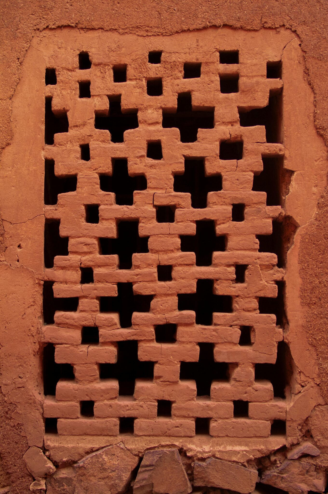
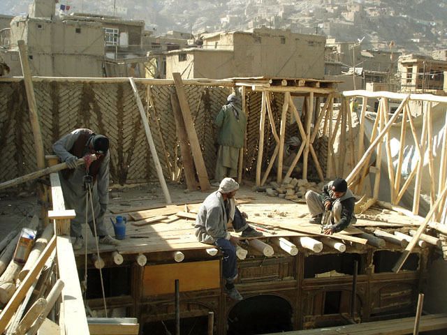
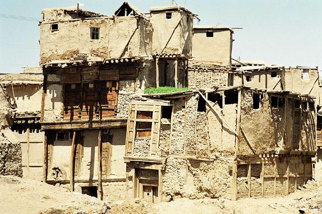
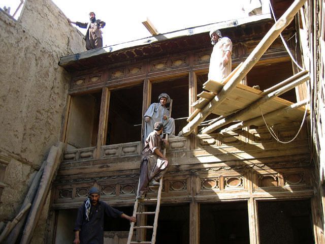
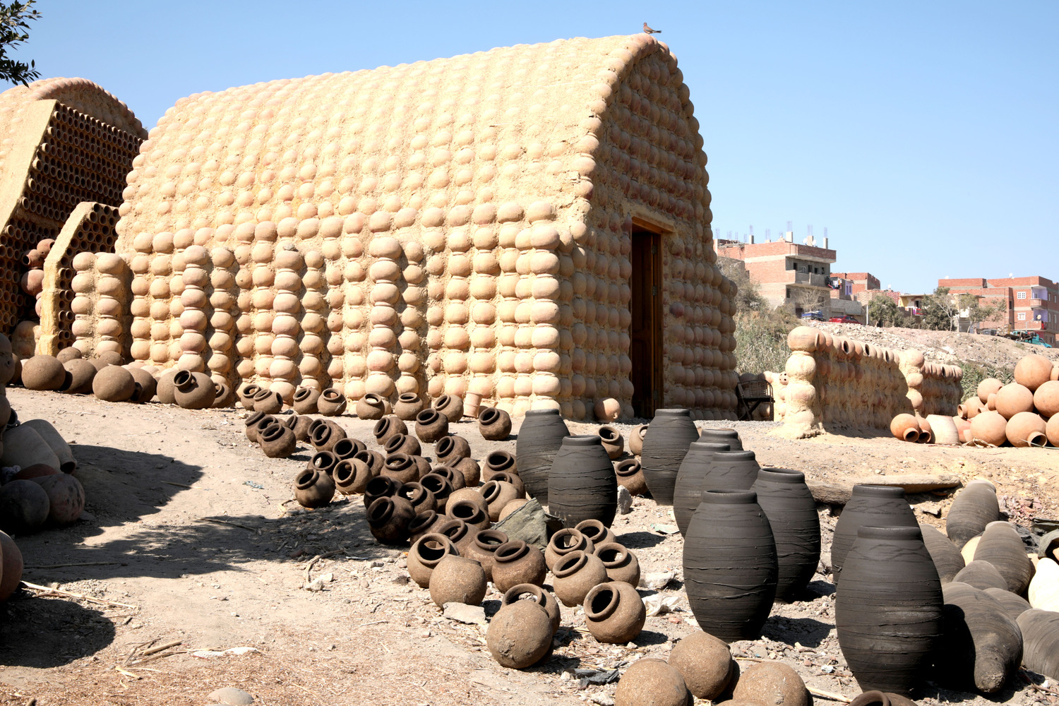
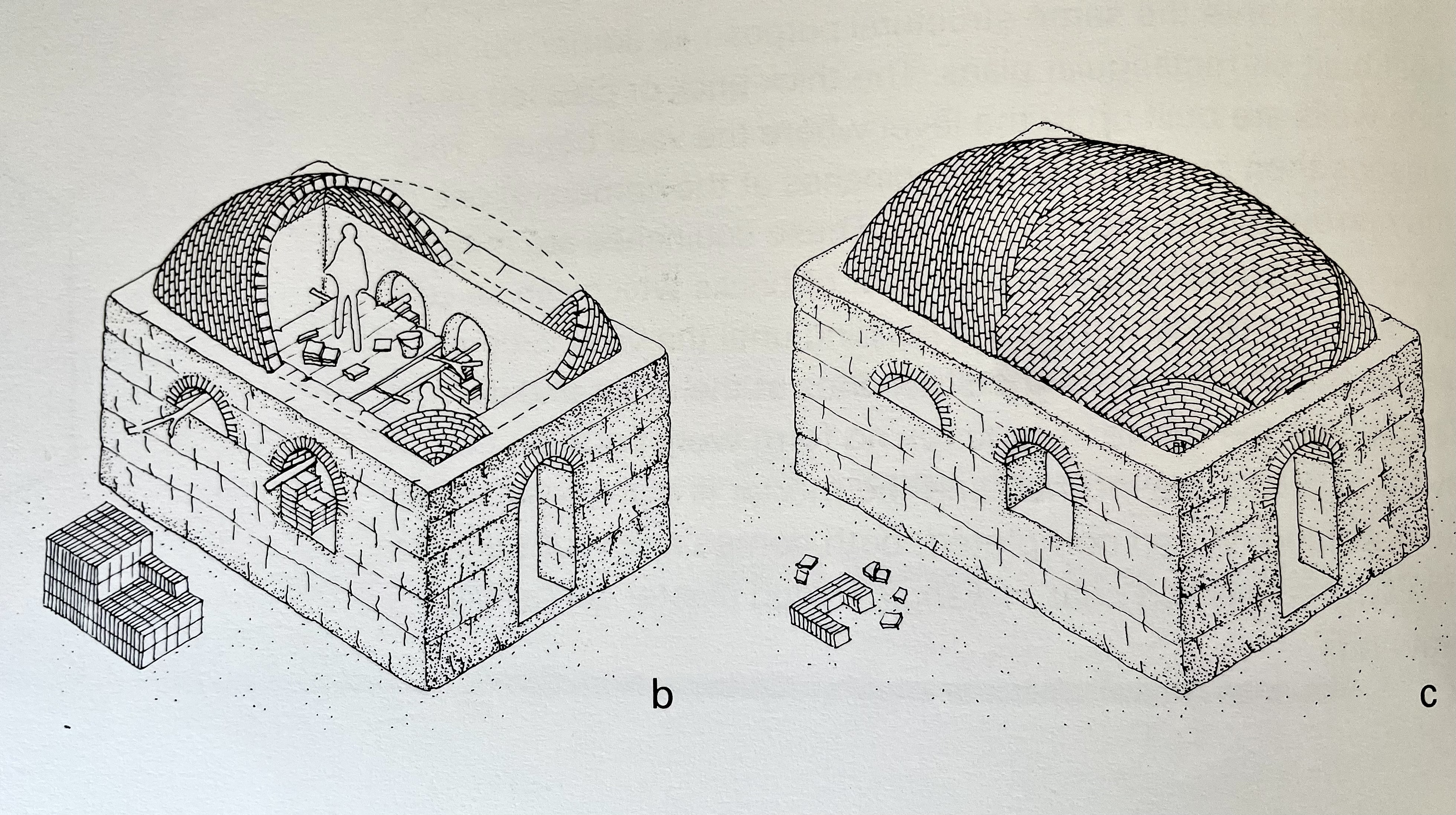
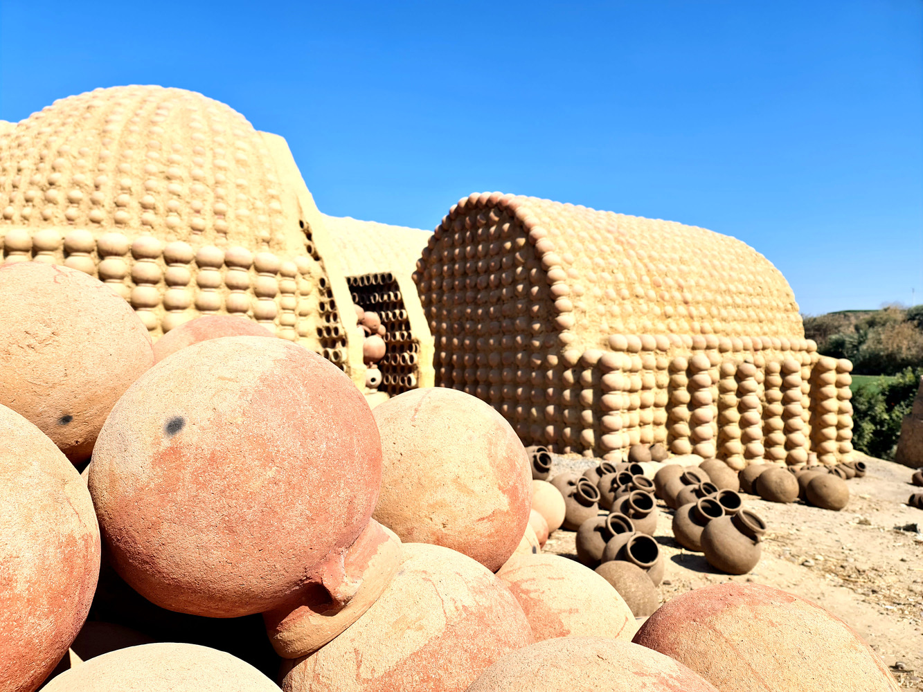
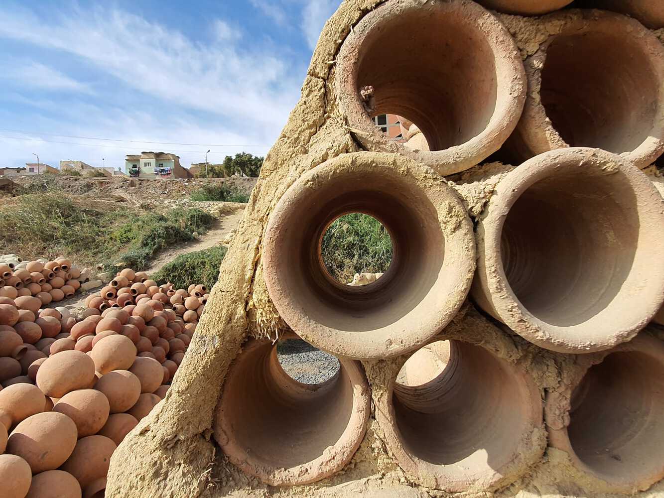
Reference images from the Al Nazlah Center by Hamdy El-Setouhy

We layered clay and pottery in sequential phases. Our initial dome structure  received embedded pots, adhesive coating with strong glue, and curing time.


We added a second clay layer to strengthen the form, followed by targeted drilling to reveal the pots from the interior of the dome . We filled joints with a second layer of clay for more stability and sanded the surface for a refined finish.

The completed dome sits on a brick foundation, raising it above ground level. Our project demonstrates the potential of traditional materials in contemporary architecture, combining ancient pottery techniques with modern structural approaches.

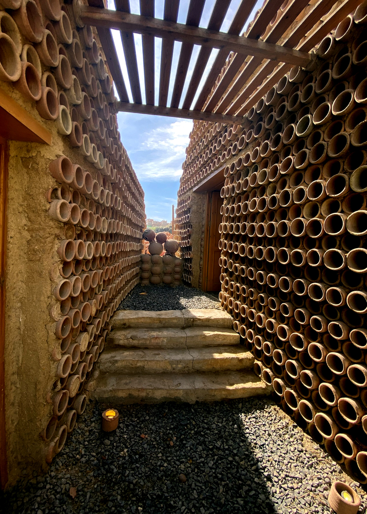
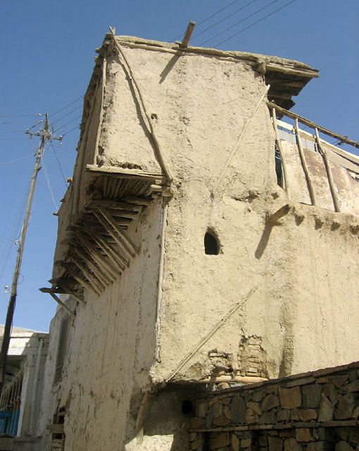
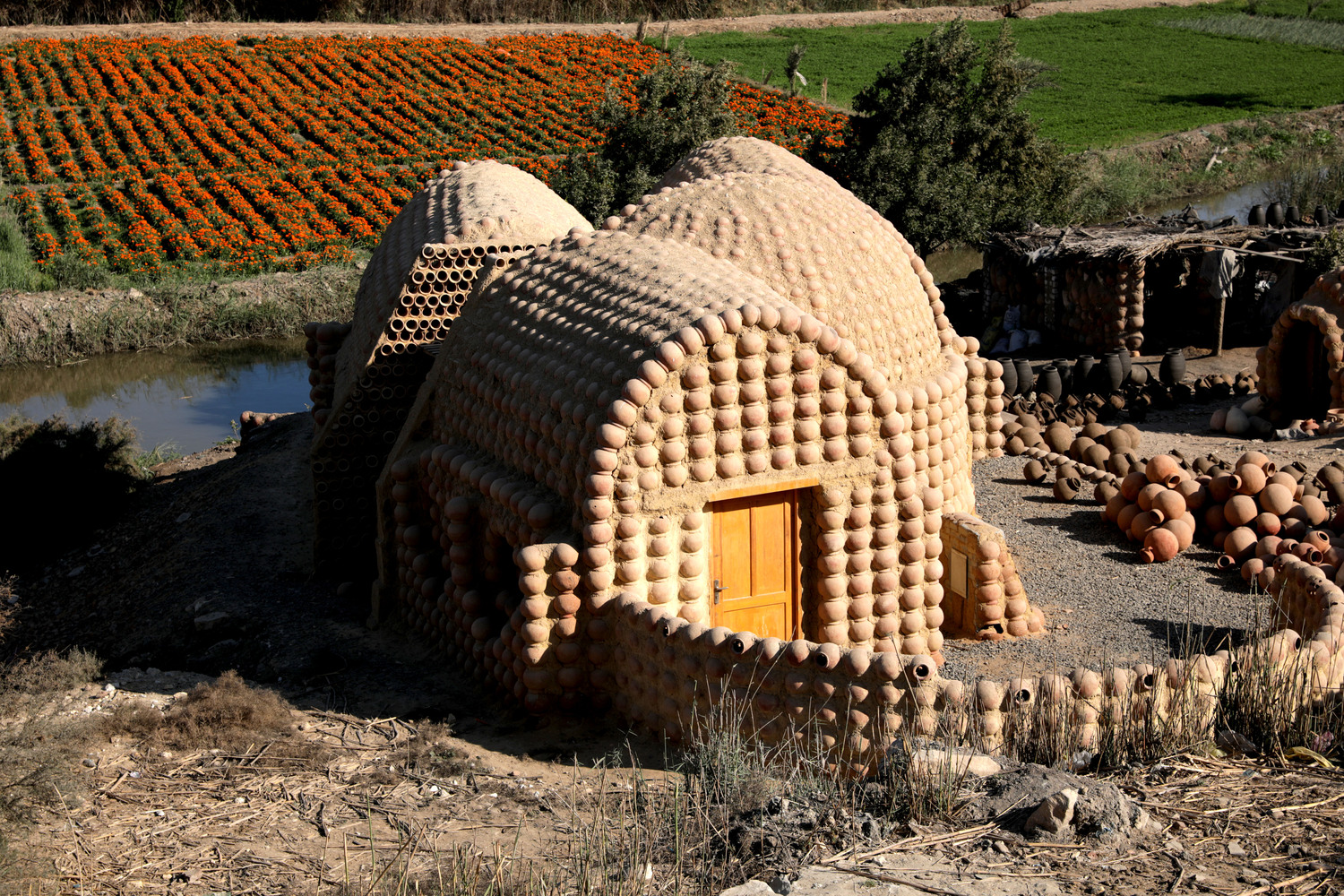
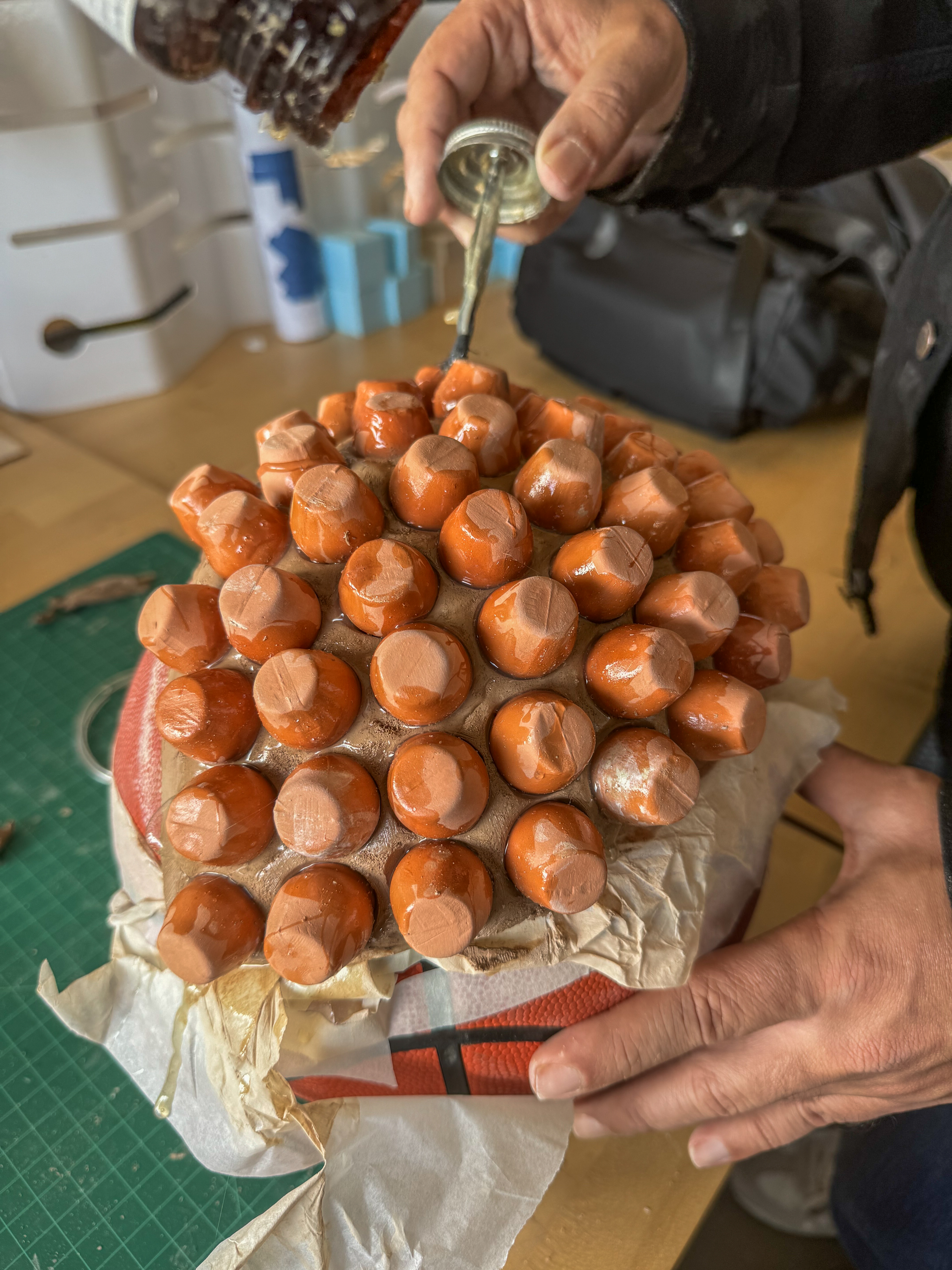
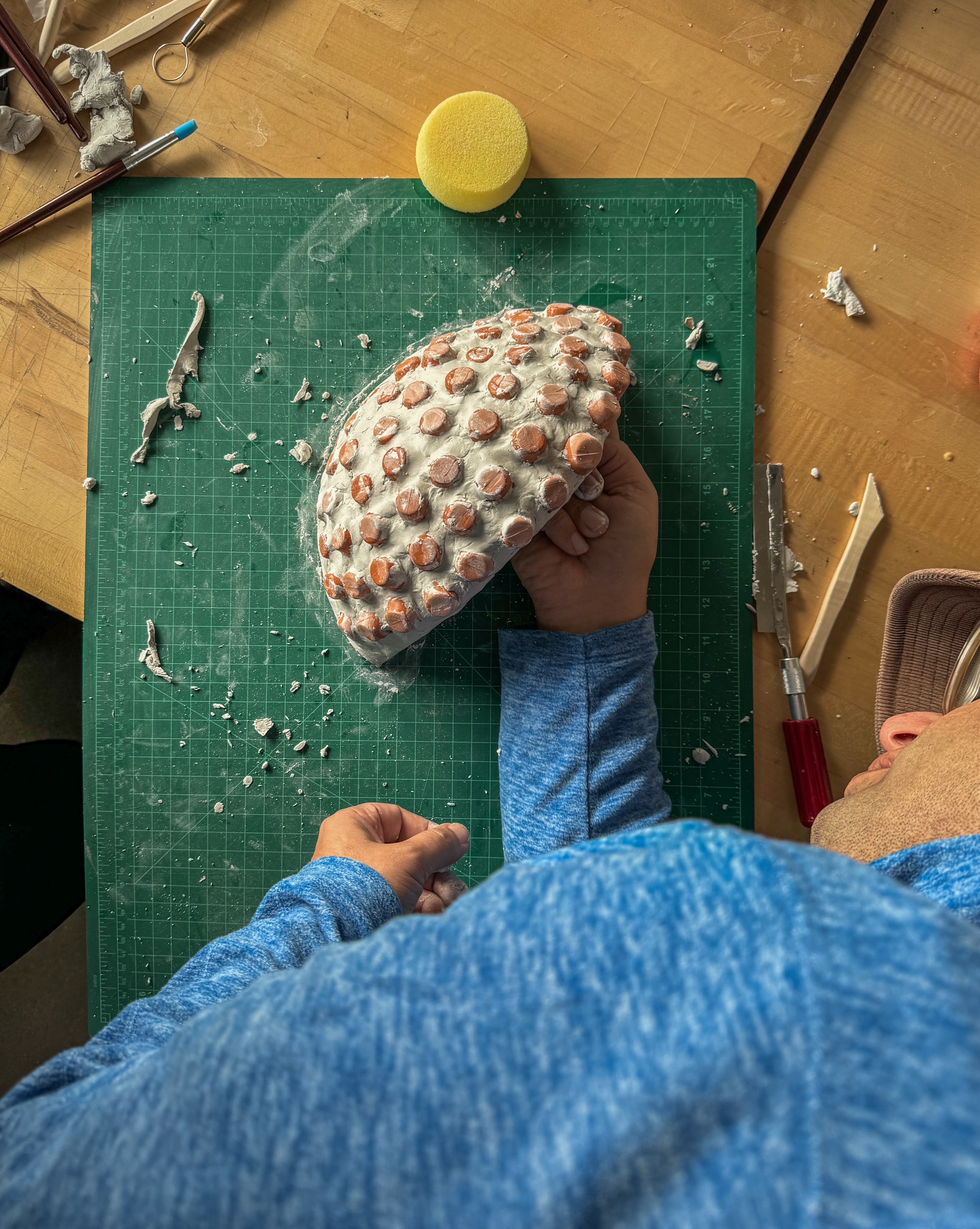
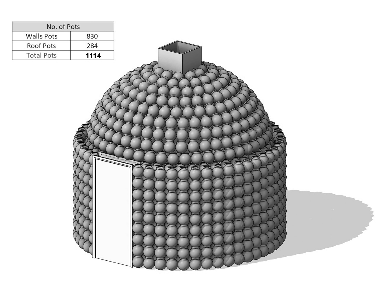
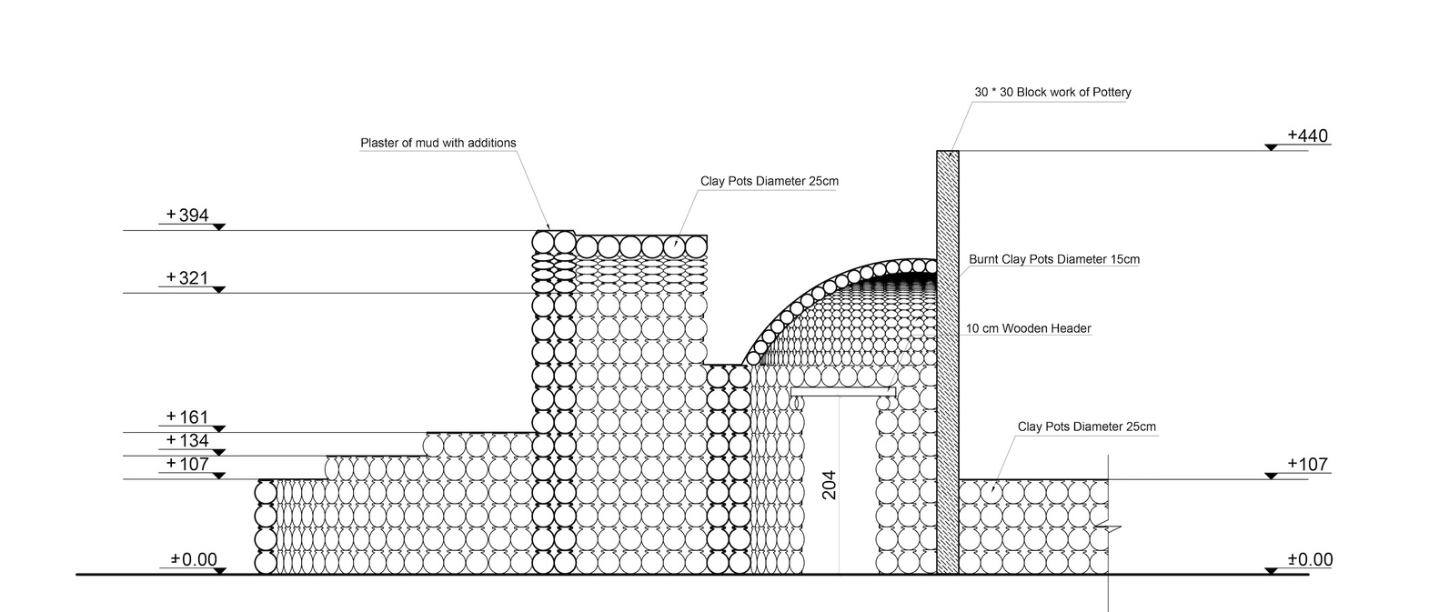
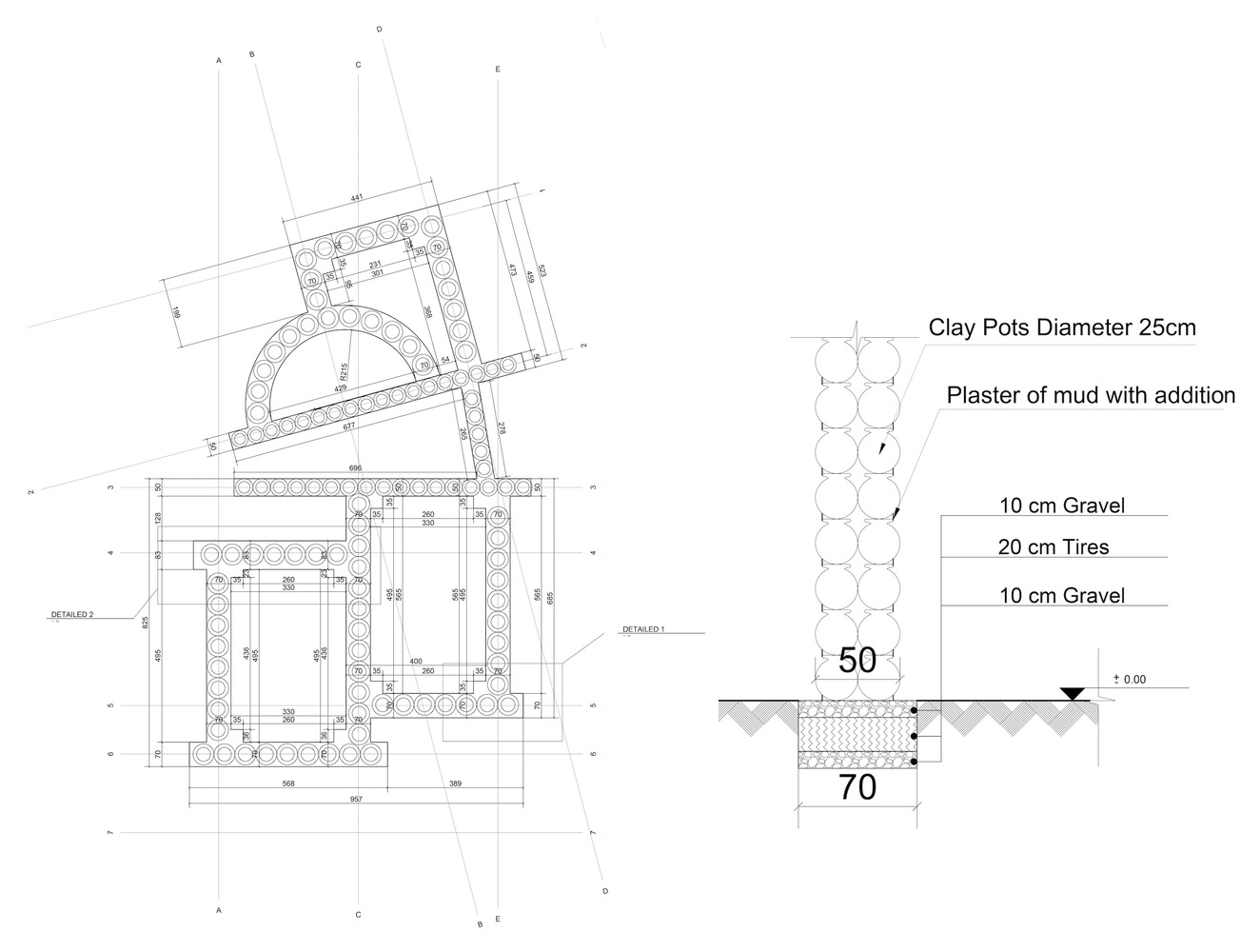
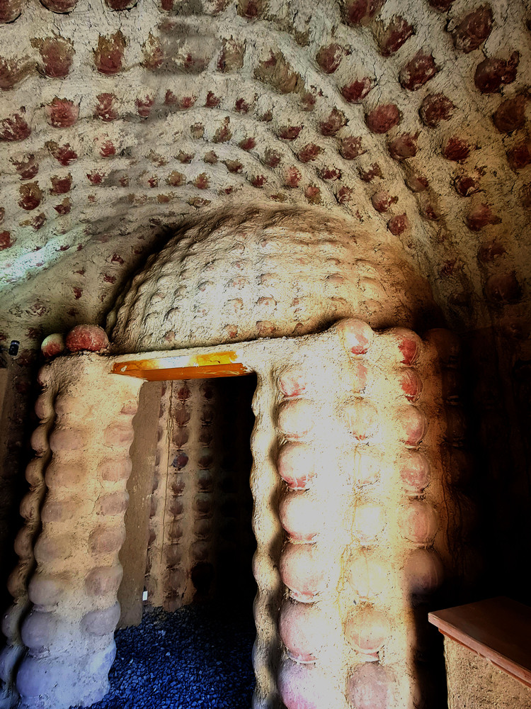
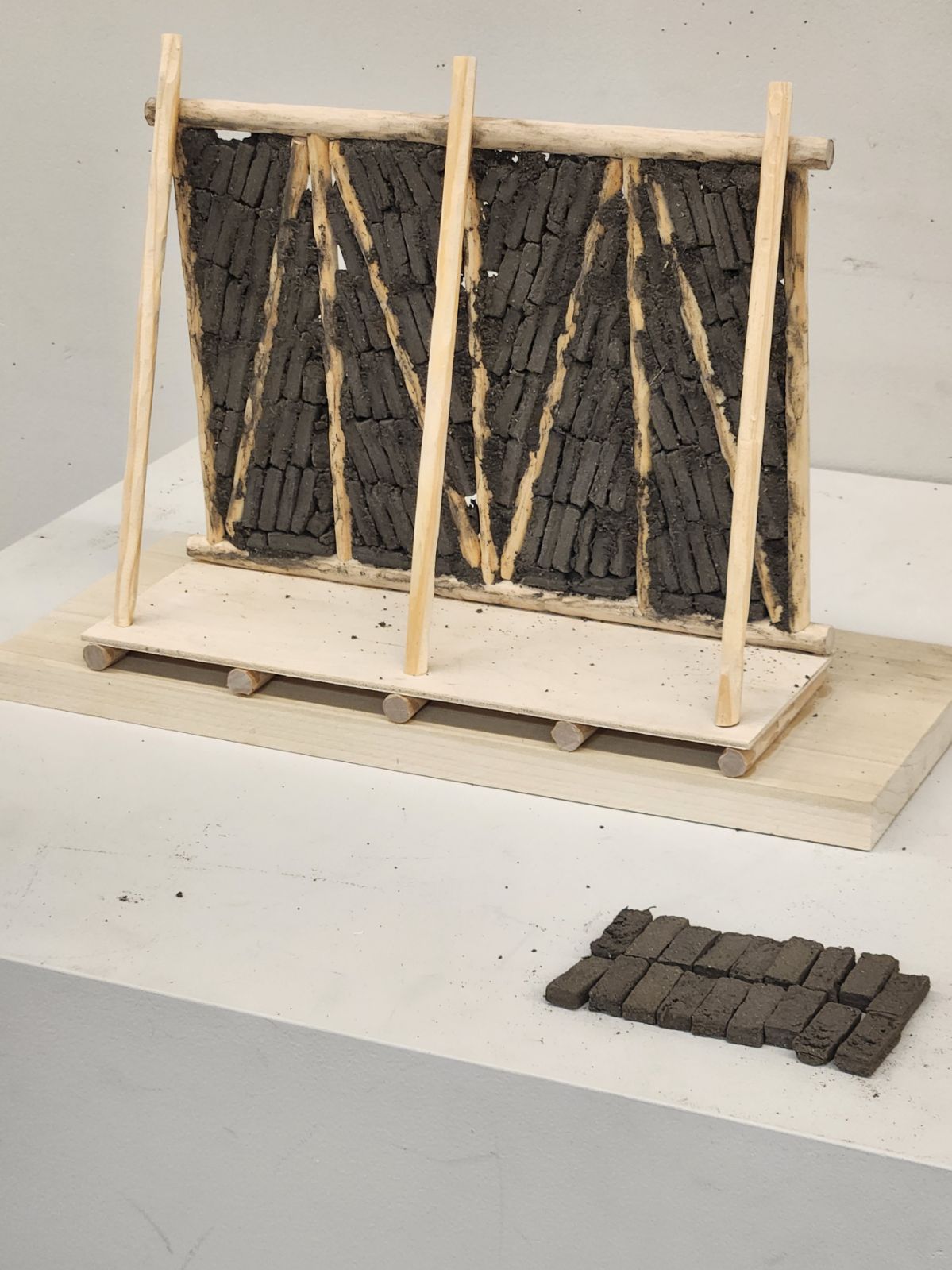
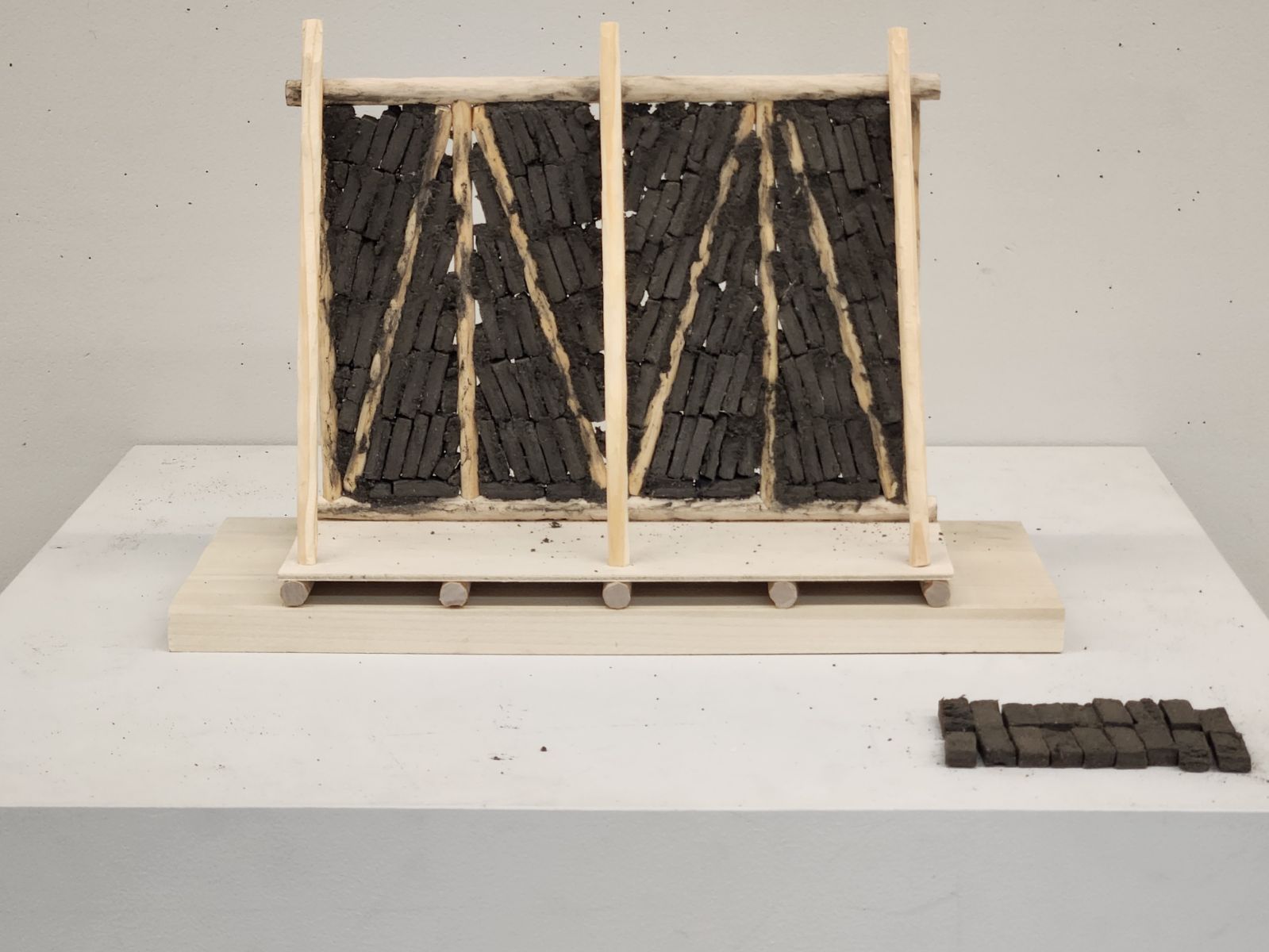
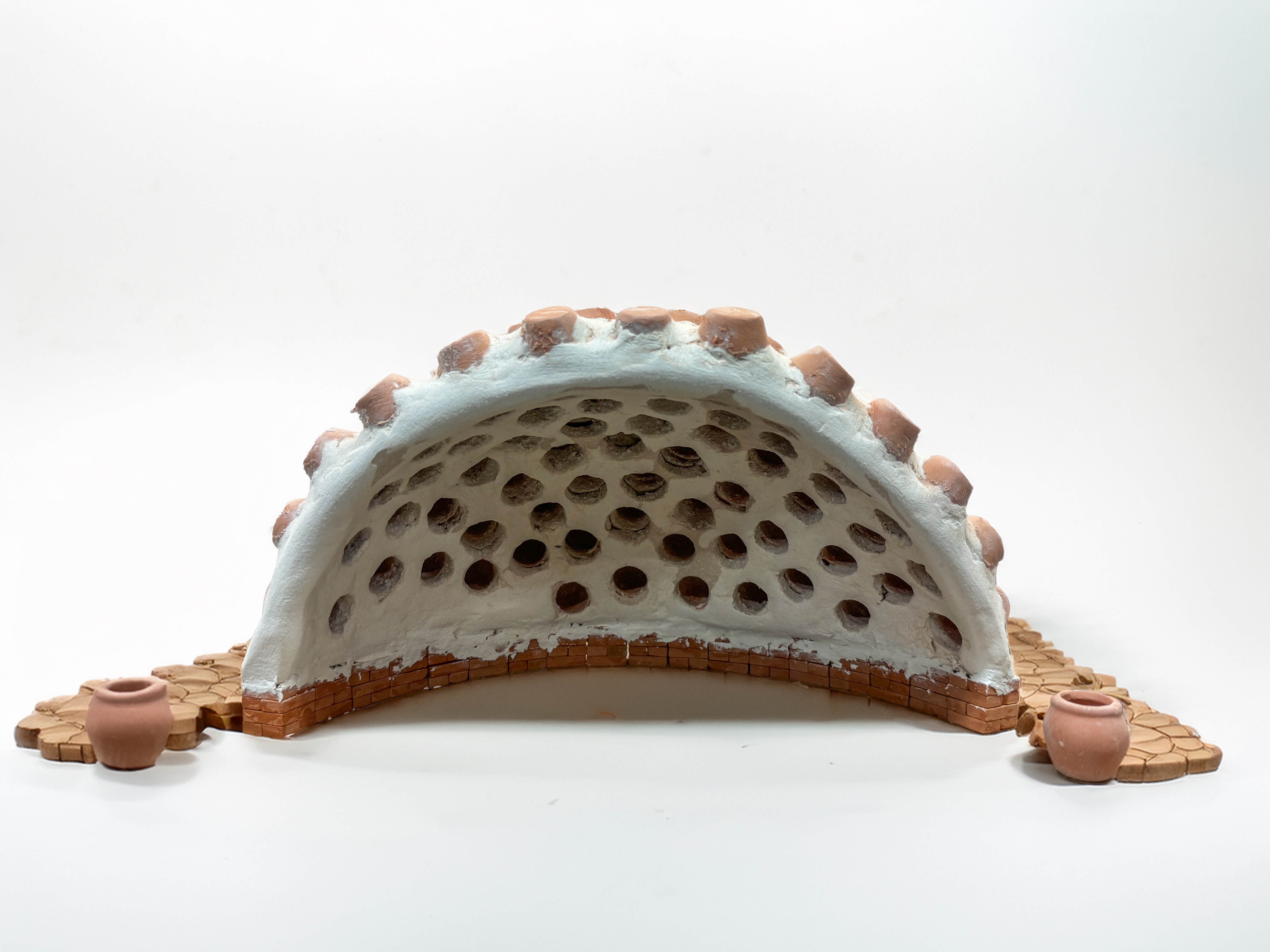
Proposal dome model. Scale: 1/4″=1′ 

The Poet of the Adobe

Haydar Yaghma, a humble yet prolific Iranian Poet, carved his legacy not only in verse but in the earth itself. Born into a life of labor, Yaghma spent his days shaping adobe bricks—a traditional craft in Iran’s sunbaked landscapes—while his nights were filled with the spirit of words and ideas. Despite his profession, Yaghma’s poetic talent soared; he composed over 5,000 verses that speak to the beauty of simplicity, the resilience of the working class, and the profound connection between humanity and the land. His verses, grounded in the experiences of everyday life, offer readers a raw and unfiltered view into the soul of a man who, though seemingly bound to the soil, found liberation in poetry. Haydar Yaghma remains an emblem of authenticity and passion in Persian literature, bridging the gap between the hands that labor and the mind that dreams.

Reviving Al Nazlah Center: Oriental Group Architects + Hamdy El-Setouhy


The Al-Nazlah Center is a project designed by Oriental Group Architects in collaboration with Hamdy El-Setouhy to revitalize the Al-Nazlah area in Fayoum, Egypt.


Where is Al-Nazlah in Fayoum ?

Fayoum is a region, located about 100 kilometers (62 miles) southwest of Cairo. It is situated in a natural depression within the Western Desert of Egypt and is connected to the Nile River through the Bahr Yussef canal, which makes the area fertile and suitable for agriculture.

Fayoum is known for its rich history and archaeological significance important region during ancient Egyptian times and later under Roman and Islamic rule. The area is home to several important historical sites, including:

-Lake Qarun, one of the oldest lakes in the world.

-Wadi El Rayan, a nature reserve with waterfalls and wildlife.

-The Fayoum Oasis, known for its ancient temples and ruins, such as the Temple of Sobek, the crocodile god.

Fayoum is also recognized for its traditional pottery-making, a craft that has been passed down through generations, especially in villages like Al-Nazlah, making it a cultural hub for Egyptian artisans.

Who is Hamdy El Setouhy?

Hamdy El-Setouhy is an Egyptian architect known for his work in sustainable and community-focused architecture. He emphasizes designs that integrate local culture, materials, and traditional building techniques while addressing contemporary challenges such as environmental sustainability and community development.

El-Setouhy has gained recognition for projects that aim to improve the quality of life in local communities through thoughtful and contextually appropriate architecture. His work often centers on promoting traditional craftsmanship and supporting local economies by incorporating artisanal skills into his designs. This is evident in projects like the Al-Nazlah Center, where he collaborates with artisans to create a space that celebrates local pottery-making traditions while also serving broader social and cultural functions.

What was the design approach of the project?

The architectural approach blends contemporary design with vernacular architecture. It utilizes local building materials and techniques, helping the structure harmonize with its environment. This approach also reduces the ecological footprint of the building by minimizing resource-intensive imports.

The renowned district is home to pottery workshops that have been crafting unique pots used in construction since the time of Ancient Egyptian Civilization. To preserve this traditional technique, modern advancements in construction were made, enhancing the bonding materials by adhering the pots together through lab-tested methods. Additionally, new forms of roofing construction were introduced, allowing the local community to expand their architectural possibilities by using pots to build domes and vaults, enabling wider spans.

How does it work?

The innovative use of the traditional pot as a construction material. Each pot has a 25 cm diameter, a clay thickness of 7 mm, and a hollow interior. By interlocking the pots, a continuous arch is formed, creating a strong load-bearing structure. The repetition and variation of these elements result in diverse spatial configurations and unique roofing designs. The project’s environmental sustainability is highlighted by its zero-waste construction process. Visitors experience an eco-friendly climate within the building, where internal temperatures remain comfortable and in harmony with the surrounding environment.

The geometrical patterns used in the roof construction allow diffused sunlight to enter the space, significantly reducing interior temperatures. This design strategy minimizes heat transfer compared to conventional reinforced concrete and mud brick methods. The project has revitalized a heritage craft by preserving a nearly extinct construction technique, incorporating it into a contemporary architectural expression. It invites visitors to explore aesthetic and spatial innovations while honoring the cultural legacy of the region.

The Al-Nazlah Center stands as a testament to how architecture can play a crucial role in not only the built environment but also in uplifting and preserving cultural traditions.

Recognition and Awards:

The project has been awarded the second prize of the Baku International Architecture Award) in 2019, Category A, with the support of the UIA (Union of International Architects) for creating a sustainable environmental development nucleus that has many positive impacts on the whole region.

The project was nominated to receive the Aga-Khan Award in the last cycle of 2022. Also, it was shortlisted for the Arab Association Award for the last cycle of 2022. Several media coverages and academic field trips have drifted local and international attention to the village to explore the project’s potential.